Największy na świecie niekomercyjny serwis geocachingowy
GeoŚcieżki - skupiające wiele keszy
Ponad 1000 GeoŚcieżek w Polsce!
Pełne statystyki, GPXy, wszystko za darmo!
Powiadomienia mailem o nowych keszach i logach
Centrum Obsługi Geokeszera wybierane przez Społeczność
100% funkcjonalności dostępne bezpłatnie
Przyjazne zasady publikacji keszy
Show cache statistics
![](/images/blue/kompas.png)
Please log in to see the coordinates.
![](images/free_icons/mountain.png)
Altitude: 57 m. ASL.
![](images/free_icons/world.png)
Region:
Poland > zachodniopomorskie
![](images/free_icons/box.png)
Cache type:
Traditional
![](images/free_icons/package_green.png)
Size:
Micro
![](images/free_icons/page.png)
Status:
Ready for Search
![](images/free_icons/date.png)
Date hidden: 01-05-2018
![](images/free_icons/date.png)
Date created: 01-05-2018
![](images/free_icons/date.png)
Date published: 01-05-2018
![](images/free_icons/date.png)
Last modification: 01-05-2018
![](images/log/16x16-found.png)
12x Found
![](images/log/16x16-dnf.png)
0x Not found
![](images/log/16x16-note.png)
0 notes
0 watchers
![](images/free_icons/vcard.png)
30 visitors
![](images/free_icons/thumb_up.png)
8 x rated
![](images/cache-rate.png)
Rated as:
Good
In order to view coordinates and
the map of caches
you must be
logged in
Cache attributes
Description
PL
Miejsce: Ciekawe miejsce odpoczynku przy czerwonym i czarnym szlaku rowerowym.
![e29d147f-6771-459c-a037-d81287cca451.jpg](https://img.geocaching.com/cache/e29d147f-6771-459c-a037-d81287cca451.jpg)
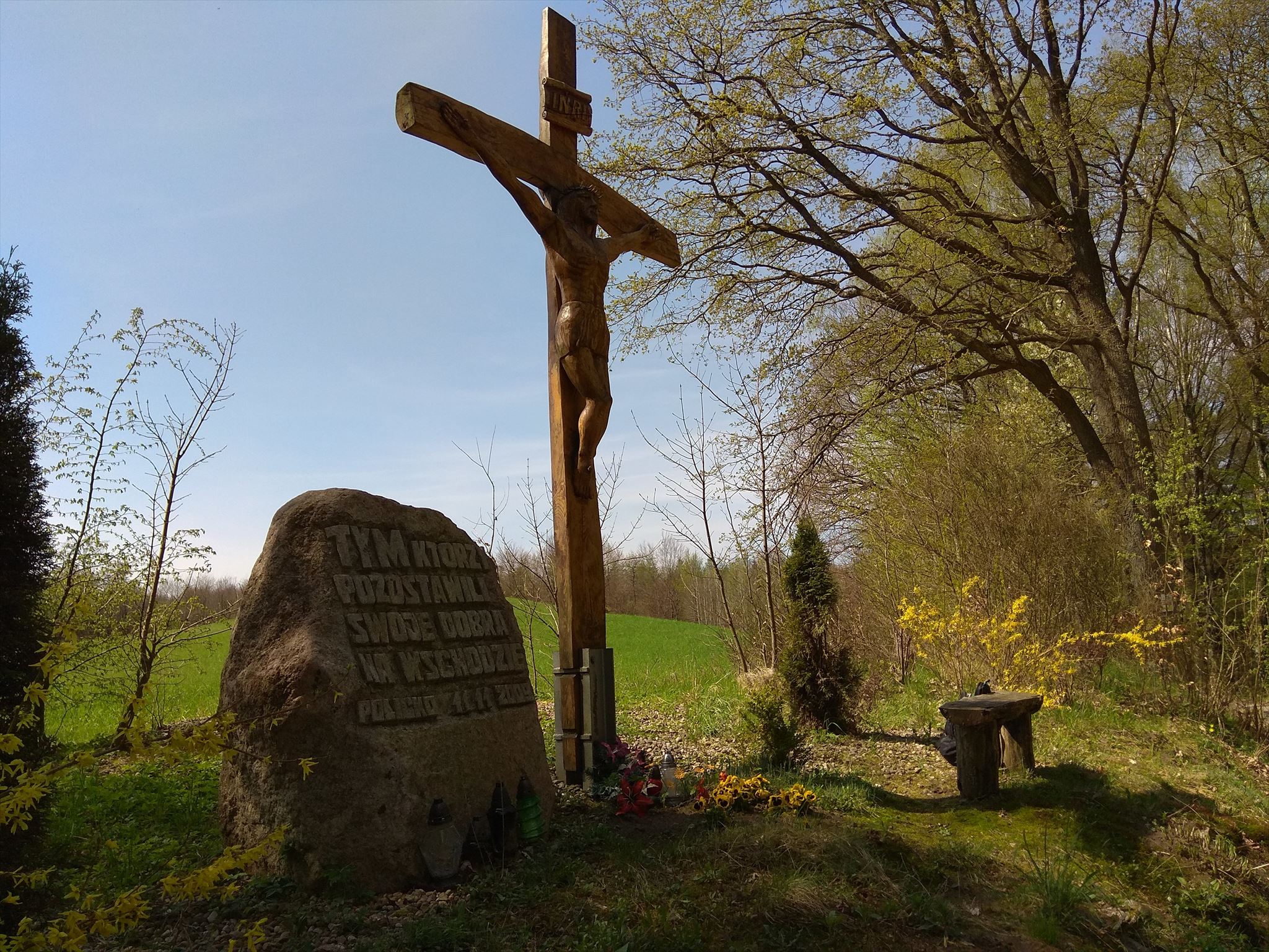
Skrzynka: mały pojemnik na współrzędnych. Mikrus - ale z pisakiem.
Additional hints
You must be logged-in to see additional hints
Log entries:
12x
0x
0x
All entries