

 Zaloguj się, by zobaczyć współrzędne.
 1x znaleziona
  0x nieznaleziona
  0 komentarze
  0 obserwatorów
  Oceniona jako: b.d.


aby zobaczyć współrzędne oraz
mapę lokalizacji skrzynki
 Atrybuty skrzynki


 Opis
Opis
This cache will challenge you and show your physical limits! Take everything you can carry - for who knows what you need?!? Give your relatives know where you will be, make sure that you return safely.
One more thing to notice before you leave: There is no circular path starting point (coordinates above) and cache are far apart. Please pay attention to the long return journey! In order to ensure that at least a part of the community of cachers is able to find the can, some indications and help are given below. Emboss them well or print them out - on the way you are on your own. In addition to the oculus (with the exception of the night vision device, since there is no night cache) you should have enough cerebrum to find the cache.
This cache should really only be practiced Cacher tackle, because after all, it is a multi-cache, thus a cache with quite a lot of stations (at least more than one). I advise you for security, not to do this cache alone; Be it just a dog who can make a phone call! And certainly not at night! In due course, I will here possibly reflectors, so that the can also be searched at night. At present, the danger of running is still present!
In the following airplane you can get a rough overview (Attention: the airplane is not shown!). If you have a compass, you can also call it (North is in the picture above).
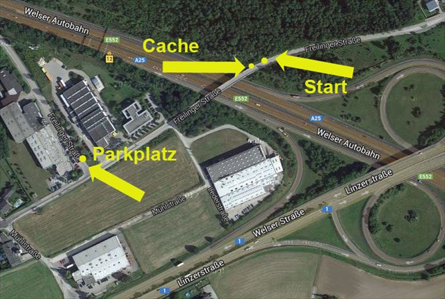
Start means roughly the place where it starts. Try to find this point on the real earth's surface - that is, at ground level (about 310 meters above sea level). If you have a GPS device at hand, this is the coordinates at the top left; Ie: N48 ° 11.360 E014 ° 04.990. Advanced caches can also use a computer and load the coordinates to the GPS device. How to do this is described in the operating instructions supplied with the device.
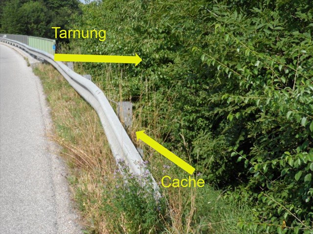
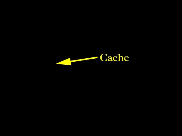
Can or Cache is the point at which the cache is located. It can also be called a final. Strictly speaking, you will find a guard rail here. Please leave this unchanged, she could save her life for future cachers. How to get to the final: see below! siehe unten!
Parking: here you could park - but you do not have to. The ride to the cache is forbidden for normal citizens. You can also choose a baby carriages here, or simply ask for a few minutes before the cache, to keep your eyes and ears, or to look for the child in the stroller.
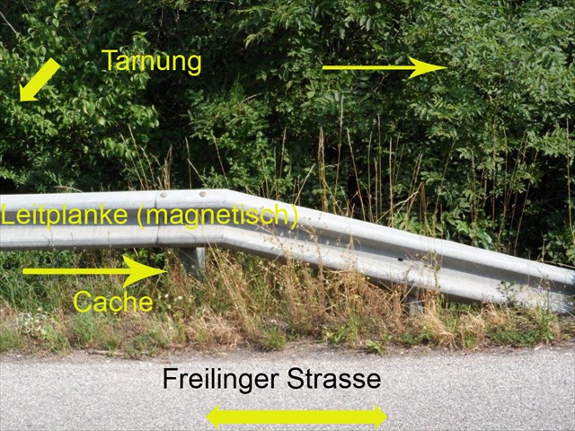
(Note for this and the following pictures: depending on the time of day, season and weather, it can look totally different.) The pictures show the situation at the time of hiding!
On your long journey to the cache you will surely pass here. (It is also from the other side, only then would the picture look completely different! To see this you have to turn your monitor). The inscriptions were fastened with cables and adhesive tape for recording and removed again after recording. So you do not have to waste your time searching the label!
On the spot the starting point looks like this:
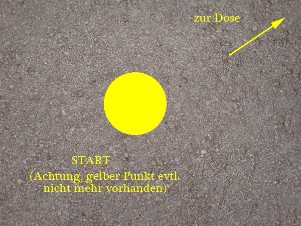
However, in some cases it may happen that the starting point has already been removed from Muggle. You do not have to inform me about this because you need your GPS for the point. I will then re-install the starting point at my next regular maintenance.
Now comes the most difficult part: the waypoint projection. If you do not have a compass, use your GPS device if it has an electronic compass - if not, your trip will end here !! From the starting point 26.82 mtr. In the direction of 279.61 ° (true). How to do this can be read in the manual - if you have it. Note: Unfortunately, the long guardrail significantly disturbs the terrestrial magnetic field. Please consider the misrepresentation in the complicated calculations. You can also look up directly at the bottom of the waypoints under "Final".
You can check your solution to the coordinates of this puzzle on geocheck.org.
.
If you have done this, your perspective should look something like this (Caution, an image is intentionally built in):
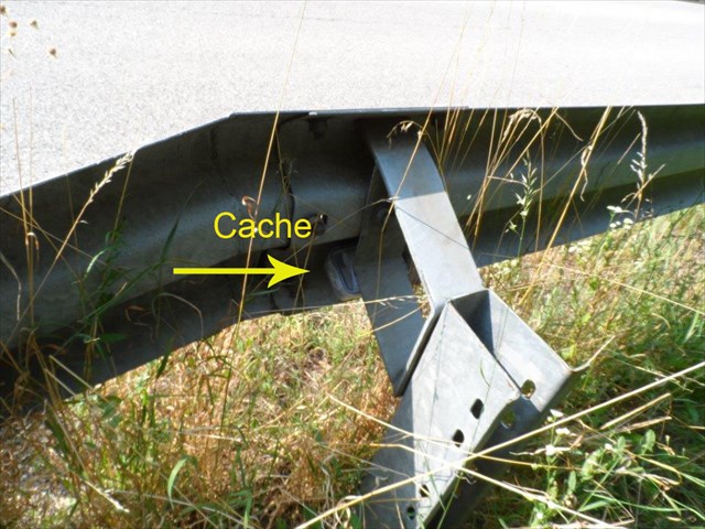
And so the can from close up looks:
And now: take off the can, open the lid, log, close the lid and re-attach the can to the guardrail "
And last but not least, there is a night spot for those who are still at night looking for doses
 OpenSprawdzacz
 Dodatkowe waypointy
| Etap | Symbol | Typ | Współrzędne | Opis |
|---|---|---|---|---|
| 1 |

|
Punkt końcowy | --- | Finale (not hidden) |
 Wpisy do logu:
1x
0x
0x
Wpisy do logu:
1x
0x
0x


