Największy na świecie niekomercyjny serwis geocachingowy
GeoŚcieżki - skupiające wiele keszy
Ponad 1000 GeoŚcieżek w Polsce!
Pełne statystyki, GPXy, wszystko za darmo!
Powiadomienia mailem o nowych keszach i logach
Centrum Obsługi Geokeszera wybierane przez Społeczność
100% funkcjonalności dostępne bezpłatnie
Przyjazne zasady publikacji keszy
You have to be logged-in in order to perform operations on this cache.
stats
Show cache statistics
RPMRUp - przystanek-droga do Buczyny - OP9HJB
Rowerem Przez MRU - południe
Owner: MatZG91
This cache belongs to GeoPath!
Please log in to see the coordinates.
Altitude: m. ASL.
 Region: Poland > lubuskie
Cache type: Traditional
Size: Micro
Status: Ready for Search
Date hidden: 27-04-2022
Date created: 09-04-2022
Date published: 30-04-2022
Last modification: 30-04-2022
23x Found
0x Not found
0 notes
watchers 0 watchers
23 visitors
13 x rated
Rated as: Good
In order to view coordinates and
the map of caches
you must be logged in
Cache attributes

One-minute cache  Take something to write  Fixed by magnet 

Please read the Opencaching attributes article.
Description PL

Skrzyżowanie drogi powiatowej 1242F Lubrza (Liebenau) - Staropole (Starpel) z drogą powiatową 1241F do Buczyny (Braunfelde) i Zagajów (Grunwald).


F961CA99-CCDE-A9C2-88FB-B9F1DE1B319C.jpg


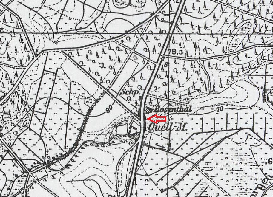
Za czasów niemieckich w sąsiedztwie: Schp. (według Zestawienia Znaków Topograficznych Map Austriackich Niemieckich i Rosyjskich Wojskowego Instytutu Geograficznego z 1925 r. skrót rozwija się jako szopa), młyn Quell-Mühle i Rosenthal.

Obecnie: przystanek PKS, pompownia zbiorcza P7-ZB, Mokradl, Trzęsawa.

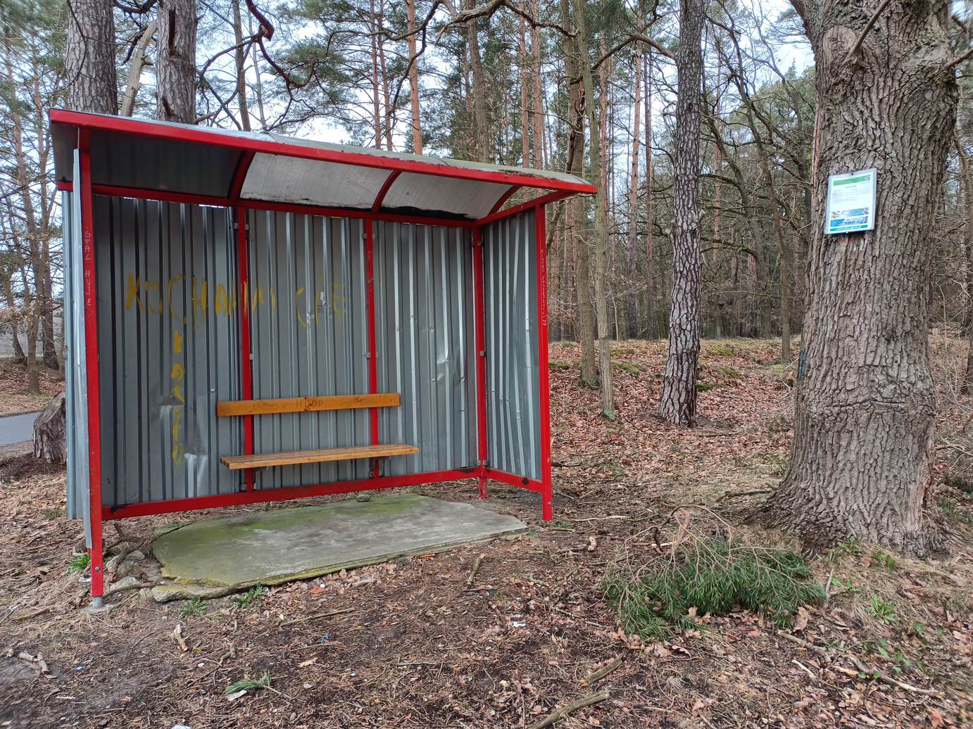
Kesz: przystanek, pod.

Rules of reactivation Reaktywacja jest możliwa, o ile istnieje pewność, że skrzynka zaginęła
Read more about reactivation of geocaches here
Pictures
Przystanek PKS
Log entries: Found 23x Not found 0x Note 0x All entries