 Please log in to see the coordinates.
 Cache attributes


 Description
PL
Nasza skrytka ma na celu zapoznanie Was z przepiękną trasą o której napisano poniżej. Pokonujemy tę trasę rowerem dość regularnie i po odkryciu geocachingu nie mogliśmy odmówić sobie połączenia tych dwóch rzeczy. Mamy nadzieję, że Wam się spodoba.
DE Wir fahren regelmäßig diese Strecke mit Fahrräder und nach der Entdeckung Geocaching könnten wir eine Kombination dieser beiden Dinge nicht widerstehen. Wir hoffen, es gefällt euch.
Pętla Bobrowicka - oznakowana droga pożarowa nr 26, wyróżniająca się utwardzonym podłożem i dodatkowo opisana kamiennymi drogowskazami z wyrytym napisem "Pętla Bobrowicka. Trasa rozpoczyna się w Nowej Koperni i wiedzie w Bory Dolnośląskie. Przechodzi obok zabytkowych Kamiennych Drogowskazów oraz przez Stawy Bobrowickie, nad którymi znajduje się Śniadanisko z drewnianą wiatą, ławkami, stołami i miejscem na bezpieczne ognisko. Utworzono tu dwa użytki ekologiczne: "Łabędzi Staw" i "Żurawie Bagno". Jest to rejon bytowania żurawi oraz miejsce polowań orła bielika. Trasę przecinają Wały Śląskie (nadłuższy obiekt archeologiczny w Polsce). Zakończenie 11,3 km trasy turystycznej znajduje się przy Leśniczówce w Bobrowicach - obecnie gospodarstwo agroturystyczne "Nad Bobrem".
DE Die "Bobersberger Schleife" ist ein markierter Feuerwehrweg, der sich durch festen Boden auszeichnet und zusäzlich mit Stein-Wegweisern mit der Inschrift "Pętla Bobrowicka" versehen ist. Die Route beginnt in Küpper bei Sprottau und führt in die Niederschlesiesche Wälder. Sie führt entlang der historischen Stein-Wegweiser und durch die Bobersberger Teiche. Hier wurden zwei ökologische Nutzflächen errichtet: "Schwanenteich" und "Kranichsumpf", in denen Kranische leben und Seeadler jagen. Die Route wird von den "Dreigräben", der längsten archäologischen Stätte Polens, durchquert. Am ende der Touristen-Route von 11,3 km befindet sich das Forsthaus in Boberwitz - zurzeit bekannt als der agro-touristische Bauernhof "Am Bober".
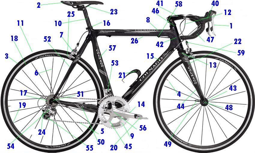
Współrzędne nie wskazują miejsca ukrycia. Jak znaleźć skrytkę? Zamiast A wstaw liczbę znajdującą się przy prawidłowej odpowiedzi na pytanie.

N 51° 29.618+A E 015° 32.238+A
 Additional waypoints
| Stage | Symbol | Type | Coordinates | Description |
|---|---|---|---|---|

|
Parking area | --- | Parking WSCHÓD | |

|
Parking area | --- | Parking PÓŁNOC |
 Additional hints
 Log entries:
 45x
45x
 0x
0x
 1x
1x


 Rated as: Good


