Największy na świecie niekomercyjny serwis geocachingowy
GeoŚcieżki - skupiające wiele keszy
Ponad 1000 GeoŚcieżek w Polsce!
Pełne statystyki, GPXy, wszystko za darmo!
Powiadomienia mailem o nowych keszach i logach
Centrum Obsługi Geokeszera wybierane przez Społeczność
100% funkcjonalności dostępne bezpłatnie
Przyjazne zasady publikacji keszy
You have to be logged-in in order to perform operations on this cache.
stats
Show cache statistics
Nądnia [Granica II RP] - OP86A7
Przebieg granicy na zachód od wsi Nądnia
Owner: mstachul
This cache belongs to GeoPath!
Please log in to see the coordinates.
Altitude: 73 m. ASL.
 Region: Poland > wielkopolskie
Cache type: Traditional
Size: Small
Status: Ready for Search
Date hidden: 19-12-2014
Date created: 11-12-2014
Date published: 19-12-2014
Last modification: 20-12-2014
37x Found
0x Not found
0 notes
watchers 0 watchers
42 visitors
31 x rated
Rated as: Good
In order to view coordinates and
the map of caches
you must be logged in
Cache attributes

Go geocaching with children  Bike  One-minute cache  GeoHotel  Take something to write  Nature  Monumental place 

Please read the Opencaching attributes article.
Description PL

Nądnia była wsią graniczną, na zachód od której, w lesie, przebiegała granica pomiędzy II Rzeczpospolitą a Niemcami. 

We wsi, przy sklepie spożywczym, znajdował się mały cmentarz z okresu powstania wielkopolskiego, na którym pochowanych było 9 żołnierzy niemieckich, poległych podczas walk o Nową Wieś. W chwili obecnej nie ma już śladu po tych grobach.

Additional hints
You must be logged-in to see additional hints
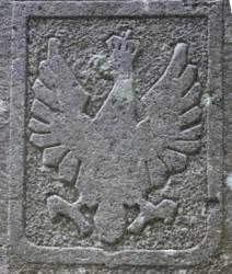
Pictures
spoiler
Log entries: Found 37x Not found 0x Note 0x All entries