

 Please log in to see the coordinates.

 Rated as: n/a


 Cache attributes


 Description
EN
Description
EN
Sviní hora (Srázná) - S vrchol (1093 m n. m.)
Protáhlý hřbet 1,5 km severozápadně od vysoké. Rulový hřbet s plochým temenem. V mapě není pojmenován, nazván podle jižněji položené Srázné (VV 198a; 1074 m), která je z hlediska tisícovek jen vedlejším vrcholem.
Prudké zalesněné svahy jsou v nižších částech svahů vystřídány loukami. Přes západní spočinek (1 004 m n. m.) vede modrá turistická značka, poblíž které je pramen. Částečné výhledy. Posed.
Přístup po asfaltové(sic!) silnici od  U Čtyř rohů (GC4H47M). Jediná tisícovka mimo NPR Králický Sněžník a zároveň korektně přístupná na kole. Vezmi si vlastní tužku. Pověšena na stromě, mnohým se v zimním období odlovit podařilo, ovšem nedokážu garantovat. Snaha rozhodně byla.
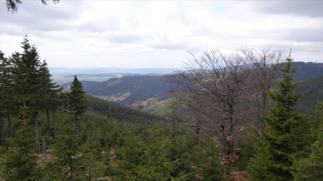
Výhled z posedu, foto od kačera posmera z logu ![]() GLQMT17V
GLQMT17V
View from elevated hunting device.
Sviní hora (Srázná) - S vrchol (1093 m n. m.)
Elongated ridge 1.5 km northwest of high. The flat top of the roulette ridge. It is not named in the maps, named in the south and precipitated (VV 198a; 1074 m), which is only a minor peak in terms of thousands. The steep wooded slopes are replaced by meadows in the lower slopes. Across the Western Rest (1,004 m above sea level) There is a fresh water spring near blue hiking trail. Some views. A hunting device for wider views. Bring your own pen. Tried my best to make the cache findable in winter. Happy caching!
Access to asphalt (sic!) Road from U Čtyř rohů (GC4H47M). Only one thousand outside of the National reservation Kralicky Sneznik and at the same time correctly accessible by bike.


[Last listing update: 19.06.2019; unsaved]
 Additional hints
 Log entries:
 1x
1x
 0x
0x
 0x
0x


