


 Zaloguj się, by zobaczyć współrzędne.
 33x znaleziona
  1x nieznaleziona
  0 komentarze
  0 obserwatorów
  Oceniona jako: znakomita


Musisz się zalogować,
aby zobaczyć współrzędne oraz
mapę lokalizacji skrzynki
aby zobaczyć współrzędne oraz
mapę lokalizacji skrzynki
 Atrybuty skrzynki


 Opis
PL
Opis
PL
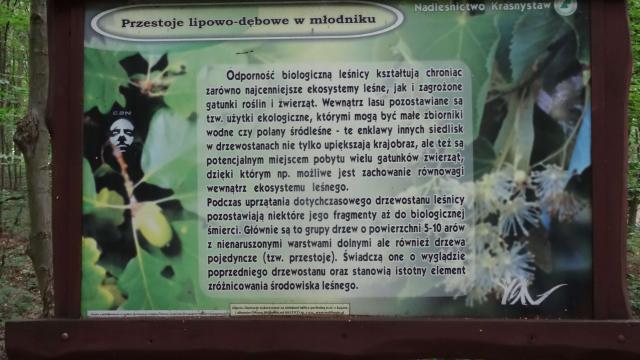
Informacje na tablicy.
Skrzyneczka - pojemnik laboratoryjny - po lewej stronie tablicy.
Powodzenia.
 Dodatkowe informacje
Musisz być zalogowany, aby zobaczyć dodatkowe informacje.
 Obrazki/zdjęcia

 Wpisy do logu:
33x
1x
0x
Wpisy do logu:
33x
1x
0x


