

 Zaloguj się, by zobaczyć współrzędne.
 4x znaleziona
  0x nieznaleziona
  0 komentarze
  0 obserwatorów
  Oceniona jako: b.d.


aby zobaczyć współrzędne oraz
mapę lokalizacji skrzynki
 Atrybuty skrzynki


 Opis
Opis
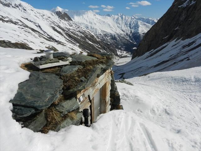
Miejsce ukrycia skrzynki jest o godzinę drogi od parkingu Lucknerhaus (1.948m) obok Lucknerhütte (2.241m) w kierunku Luckner Hütte (2.802m). Kesz znajduje się około 2.500m n.p.m.
Znajdź go i ciesz się pięknym widokiem na góry.
Tour Kategoria: Hüttenwanderung, Wanderung
Grupy górskie: Glocknergruppe
Region: Nationalpark-Region
Start: Kals am Großglockner 1324 m
Czas docelowy: 2,5 - 3 godziny.
Czas razem: 4,5 do 5 godzin.
Różnica wysokości: 861 Hm
Długość docelowa: 4,6 km
Długość całkowita ścieżki : 9,2 km
Punkt wyjścia: parking Lucknerhaus, 1948 m
Trudność: ciężka, czerwone szlaki górskie
Ponieważ jest to niezbyt łatwa trasa (szlak czerwony), ocena terenu została zdefiniowana jako 4.5, co nie ma zniechęcać do poszukiwań kesza.
 Dodatkowe informacje
 Obrazki/zdjęcia

 Wpisy do logu:
4x
0x
0x
Wpisy do logu:
4x
0x
0x


