Największy na świecie niekomercyjny serwis geocachingowy
GeoŚcieżki - skupiające wiele keszy
Ponad 1000 GeoŚcieżek w Polsce!
Pełne statystyki, GPXy, wszystko za darmo!
Powiadomienia mailem o nowych keszach i logach
Centrum Obsługi Geokeszera wybierane przez Społeczność
100% funkcjonalności dostępne bezpłatnie
Przyjazne zasady publikacji keszy
Show cache statistics
![](/images/blue/kompas.png)
Please log in to see the coordinates.
![](images/free_icons/mountain.png)
Altitude: 160 m. ASL.
![](images/free_icons/world.png)
Region:
Poland > dolnośląskie
![](images/free_icons/box.png)
Cache type:
Other type
![](images/free_icons/package_green.png)
Size:
Regular
![](images/free_icons/page.png)
Status:
Ready for Search
![](images/free_icons/date.png)
Date hidden: 14-06-2015
![](images/free_icons/date.png)
Date created: 14-06-2015
![](images/free_icons/date.png)
Date published: 14-06-2015
![](images/free_icons/date.png)
Last modification: 17-06-2015
![](images/log/16x16-found.png)
12x Found
![](images/log/16x16-dnf.png)
0x Not found
![](images/log/16x16-note.png)
0 notes
1 watchers
![](images/free_icons/vcard.png)
49 visitors
![](images/free_icons/thumb_up.png)
7 x rated
![](images/cache-rate.png)
Rated as:
Excellent
In order to view coordinates and
the map of caches
you must be
logged in
Cache attributes
Description
PL
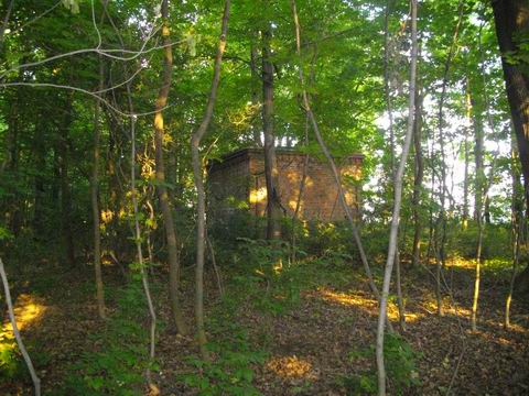
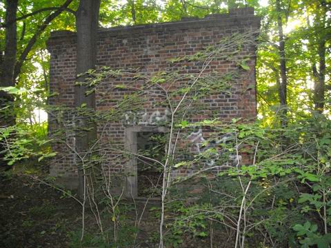
Dziwny budynek bez dachu na skraju lasu. Wg tubylców którzy niejedno pamiętają
była to szubienica.
Szukaj kesza 27 kroków od wejścia do przodu, po czym 15 kroków w lewo.
Czekają certyfikaty!
Additional hints
You must be logged-in to see additional hints
Pictures