Największy na świecie niekomercyjny serwis geocachingowy
GeoŚcieżki - skupiające wiele keszy
Ponad 1000 GeoŚcieżek w Polsce!
Pełne statystyki, GPXy, wszystko za darmo!
Powiadomienia mailem o nowych keszach i logach
Centrum Obsługi Geokeszera wybierane przez Społeczność
100% funkcjonalności dostępne bezpłatnie
Przyjazne zasady publikacji keszy
geocache GeoPaths
GeoPath name
GeoPath type What is this?HelpHelpSpecifies the type of GeoPath. If the majority of caches are arranged in a line, or form a design on the map, set Geo-sketch . If the majority of caches highlight a tourist attraction (e.g. a famous building, museum, etc.) set Touristic . If the majority of caches show off a natural feature (e.g. a mountain peak, viewpoint, etc.) set Nature . If the caches have a common theme (e.g. cathedrals, famous authors, etc.) set Thematic . If you think your GeoPath should be in another category which is not listed, contact the OC Team cog (at) opencaching.pl
% cache finds required to complete GeoPath
What is this?HelpHelpAfter logging a percentage of the caches, the user may log the GeoPath as completed
GeoPath Description

Start a new GeoPath
Waypoint Cache name belongs to GeoPath  
(No caches to display)
GeoPaths
Number of displayed GeoPaths: {displayedPowerTrailsCount} Display options
Name Type {statusOrPoints} Publication date Number of caches Completed


Na Wysoką po granicy

GeoPath details
Mentor (?)HelpMentorThe mentor is the person who created the GeoPath. palinq
Visibility
Completed 0 times
Scoring 38.33 Points
Number of caches 5 (0 / 0 / 0)
% cache finds required to complete GeoPath 80% ( Geocaches)
GeoPath type Nature
Publication date 17-11-2024
Owners palinq
GeoPath's description

Spontanicznie założone kesze w drodze na kolejny szczyt do KGP - Wysoką.

Najszybszy szlak na Wysoką wiedzie przez Homole, zielonym szlakiem. Bardzo stromym.


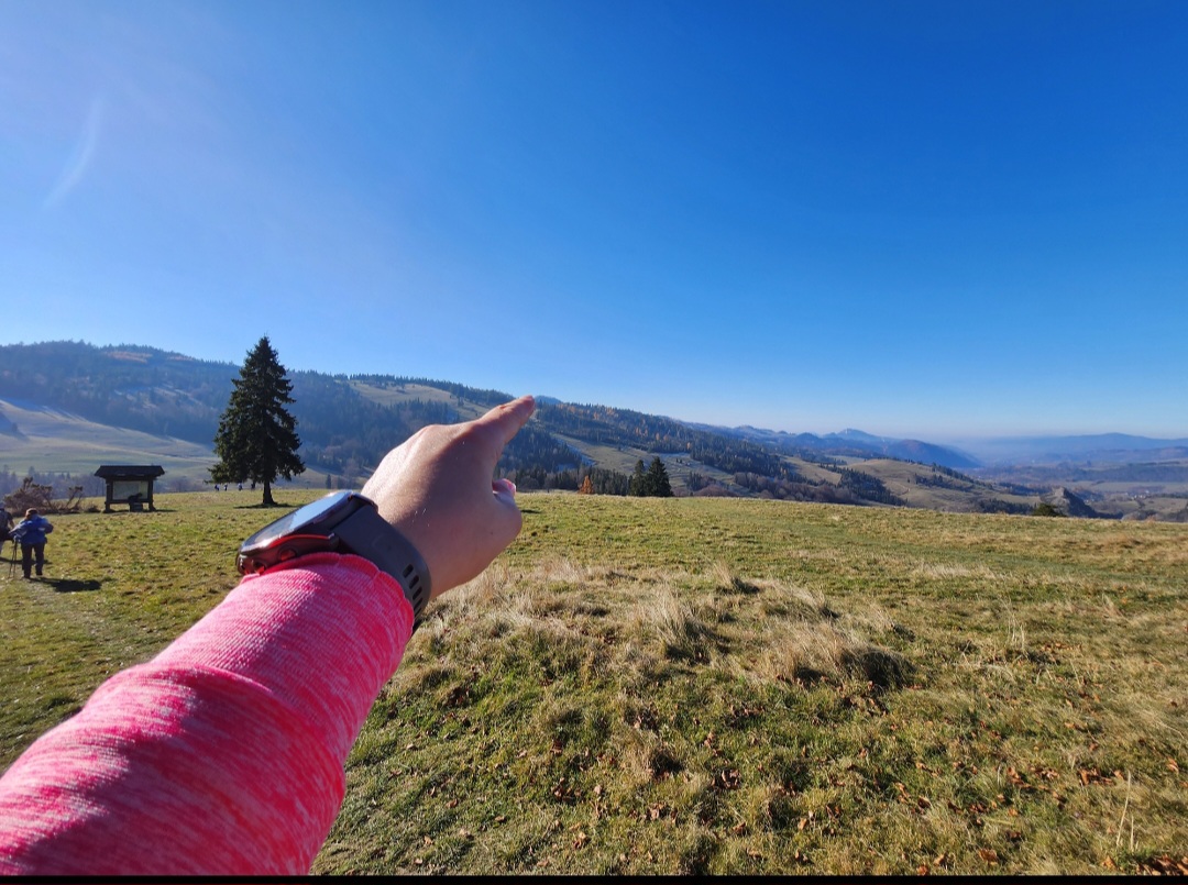
Tutaj mamy propozycję trasy alternatywnej, od strony Białej Wody, powoli, połoninami, w towarzystwie owiec (jeśli jesteś w sezonie), po granicy ze Słowacją, z cudownymi widokami na całą dolinę w której zobaczycie Szczawnicę, Jaworki i z drugiej strony pasmo Beskidu Sądeckiego z Radziejową kryjącą się pośród drzew i tylko od czasu do czasu zdradzającą się widocznym dachem wieży widokowej.


Chodź w góry, tu jest fajnie!


PS po drodze do zdobycia parę keszy z innych ścieżek - wszystko zależy którędy zdecydujecie się z Wysokiej schodzić:)

PS. zapraszamy do współtworzenia - załóż kesza i daj znać żeby go dodać:)


Uwaga spojler, tam zmierzasz!

Caches in this GeoPath Na Wysoką po granicy

include following caches in gpx file:


inactive
ignored
placed by you
watched
founded
Logs count in gpx file*: 5

*) - for each cache. Available only for "GPX" files OK
information
Statistics for this GeoPath Na Wysoką po granicy
Your progress on this GeoPath


0% (You found 0 from 5 Caches in the Geopath)

Show more statistics

Opinions and comments

Log your visit