

Show cache statistics
 Please log in to see the coordinates.
 47x Found
  0x Not found
  18 notes
  5 watchers
  Rated as: Excellent
 6 x recommended
This cache is recommended by:
arteee, filips, jaculo, lavinka, lec, wallson


 Cache attributes


 Description
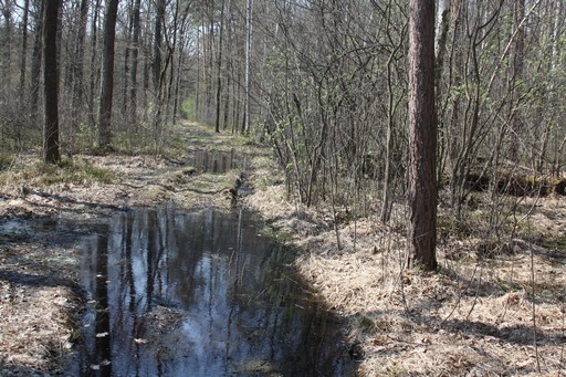
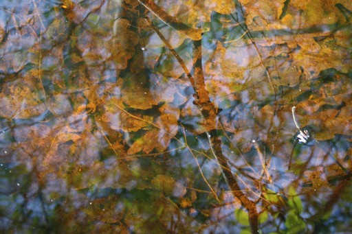
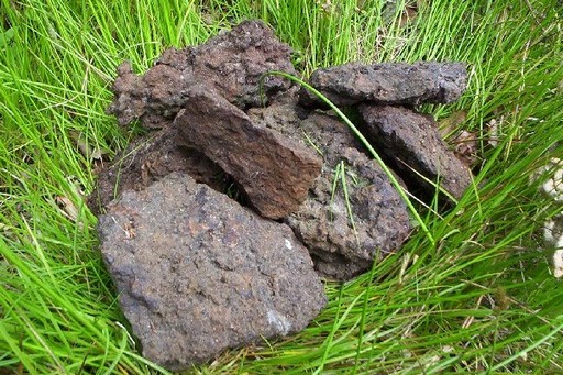
Bog ore is the iron ore with low Fe content (30%). Bog ore deposits are formed under ground in wet meadows, and forests, where water has a lot of iron dissolved in it (we can recognize it by brown color). These deposits are renewable, if the site has not been destroyed, sometimes even after a few years, deposits are ready to exploit.Bog ore is quite common in Poland. Residents of Zyrardów City, shouldn't be surprised that they have bog ore deposits in the forest near the city. Factory settlement, which was beginning o the city was founded in the village, which name was Ruda Guzowska (Guzów Ore). There are the water intake for the city in that forest, and before the commissioning of a new treatment plant, water in Zyrardów was very rich in iron and red streaks were common at the taps.
Because of its low iron content and type of deposits (thin layer), bog ore is not for industrial smelting iron now. But it is is widespread and easy accessible, and it has been used since the beginning of metallurgy in this region, until the twentieth century. However, due to its porosity and sorption properties, bog ore is sometimes used as an absorber in the filters. You can also find it used as a building material.
It is interesting that here in the Western Mazovia, was one of the two largest metallurgical centers of barbaric Europe (the only bigger one was in the Swietokrzyskie Mountains). In the period of I to IV century AD, in thousands primitive bloomerys, 3 000 tons of iron was produced! The raw material was of course the local bog ore. A lot of of this iron, was probably used to manufacture weapons, knowing that 1kg of iron was needed to produce one sword, you can imagine how big army could be armed. Mazovian and Swietokrzyskie metallurgical centers provided weapons to barbarians, who set out to conquer the Roman Empire. With the fall of Rome, the Germanic tribes moved west and south, and it was the end of the mass production of iron in these lands.
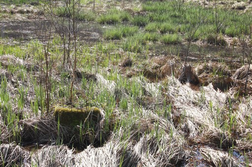
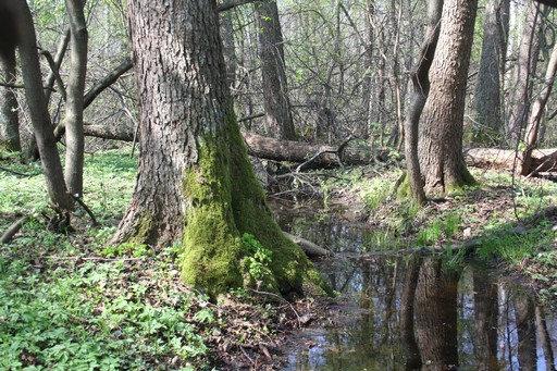
I didn't chose hiding place randomly, because here I found my first piece of bog ore. After the cutting trees, and plowing area near the stream to plant new trees, under crops in the area of stream, pieces of bog ore were lieing on the surface. Now there's a boggy meadow, partly overgrown with bushes, but if you go north along the stream, you can see how this area looked like before cutting the trees.
Geocache is hidden in the roots. There are special certificates for every geocacher (now 10 inside, but I can put more anytime), just take one, you don't have to leave any item instead :-)
Because of its low iron content and type of deposits (thin layer), bog ore is not for industrial smelting iron now. But it is is widespread and easy accessible, and it has been used since the beginning of metallurgy in this region, until the twentieth century. However, due to its porosity and sorption properties, bog ore is sometimes used as an absorber in the filters. You can also find it used as a building material.
It is interesting that here in the Western Mazovia, was one of the two largest metallurgical centers of barbaric Europe (the only bigger one was in the Swietokrzyskie Mountains). In the period of I to IV century AD, in thousands primitive bloomerys, 3 000 tons of iron was produced! The raw material was of course the local bog ore. A lot of of this iron, was probably used to manufacture weapons, knowing that 1kg of iron was needed to produce one sword, you can imagine how big army could be armed. Mazovian and Swietokrzyskie metallurgical centers provided weapons to barbarians, who set out to conquer the Roman Empire. With the fall of Rome, the Germanic tribes moved west and south, and it was the end of the mass production of iron in these lands.
I didn't chose hiding place randomly, because here I found my first piece of bog ore. After the cutting trees, and plowing area near the stream to plant new trees, under crops in the area of stream, pieces of bog ore were lieing on the surface. Now there's a boggy meadow, partly overgrown with bushes, but if you go north along the stream, you can see how this area looked like before cutting the trees.
Geocache is hidden in the roots. There are special certificates for every geocacher (now 10 inside, but I can put more anytime), just take one, you don't have to leave any item instead :-)
 Additional hints
You must be logged-in to see additional hints
 Pictures

 Log entries:
47x
0x
18x
Log entries:
47x
0x
18x


