Największy na świecie niekomercyjny serwis geocachingowy
GeoŚcieżki - skupiające wiele keszy
Ponad 1000 GeoŚcieżek w Polsce!
Pełne statystyki, GPXy, wszystko za darmo!
Powiadomienia mailem o nowych keszach i logach
Centrum Obsługi Geokeszera wybierane przez Społeczność
100% funkcjonalności dostępne bezpłatnie
Przyjazne zasady publikacji keszy
geocache GeoPaths
GeoPath name
GeoPath type What is this?HelpHelpSpecifies the type of GeoPath. If the majority of caches are arranged in a line, or form a design on the map, set Geo-sketch . If the majority of caches highlight a tourist attraction (e.g. a famous building, museum, etc.) set Touristic . If the majority of caches show off a natural feature (e.g. a mountain peak, viewpoint, etc.) set Nature . If the caches have a common theme (e.g. cathedrals, famous authors, etc.) set Thematic . If you think your GeoPath should be in another category which is not listed, contact the OC Team cog (at) opencaching.pl
% cache finds required to complete GeoPath
What is this?HelpHelpAfter logging a percentage of the caches, the user may log the GeoPath as completed
GeoPath Description

Start a new GeoPath
Waypoint Cache name belongs to GeoPath  
(No caches to display)
GeoPaths
Number of displayed GeoPaths: {displayedPowerTrailsCount} Display options
Name Type {statusOrPoints} Publication date Number of caches Completed


Historyczne ciekawostki Rudy Śląskiej

GeoPath details
Mentor (?)HelpMentorThe mentor is the person who created the GeoPath. Zyfika
Visibility
Completed 47 times
Scoring 379.75 Points
Number of caches 54 (0 / 0 / 0)
% cache finds required to complete GeoPath 90% ( Geocaches)
GeoPath type Thematic
Publication date 03-02-2019
Owners unieski, Zyfika
GeoPath's description

Obszar obecnego miasta Ruda Śląska tworzy jedenaście dzielnic, które kiedyś stanowiły samodzielne organizmy miejskie. Kilka z nich ma rodowód średniowieczny. Najszybszy rozwój terenów obecnej Rudy Śląskiej nastąpił w XIX w., kiedy silnie zaczął rozwijać się przemysł ciężki. Zmiany wtedy zapoczątkowane doprowadziły do scalania się niezależnych dotąd miejscowości w nowe organizmy.

Miasto w dzisiejszych granicach administracyjnych powstało w dniu 1 stycznia 1959 roku z połączenia Rudy Śląskiej z Nowym Bytomiem. Te dwa zasadnicze człony również nie stanowiły jednolitych, zwartych organizmów miejskich. Ruda Śląska przed przyłączeniem obejmowała następujące jednostki terytorialne: Rudę, Godulę i Orzegów. W skład Nowego Bytomia wchodziły: Nowy Bytom, Bielszowice, Bykowina, Chebzie, Halemba, Kłodnica, Kochłowice, Stara Kuźnica i Wirek. Historyczne zróżnicowanie tych obszarów sprawia, że na charakterystykę miasta Ruda Śląska składają się jednostkowe historie i charakterystyki jego poszczególnych dzielnic.

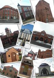
źródło : wirtualnaruda.pl


Caches in this GeoPath Historyczne ciekawostki Rudy Śląskiej

include following caches in gpx file:


inactive
ignored
placed by you
watched
founded
Logs count in gpx file*: 5

*) - for each cache. Available only for "GPX" files OK
information
Statistics for this GeoPath Historyczne ciekawostki Rudy Śląskiej
Your progress on this GeoPath


0% (You found 0 from 54 Caches in the Geopath)

Show more statistics

Opinions and comments

Log your visit