Największy na świecie niekomercyjny serwis geocachingowy
GeoŚcieżki - skupiające wiele keszy
Ponad 1000 GeoŚcieżek w Polsce!
Pełne statystyki, GPXy, wszystko za darmo!
Powiadomienia mailem o nowych keszach i logach
Centrum Obsługi Geokeszera wybierane przez Społeczność
100% funkcjonalności dostępne bezpłatnie
Przyjazne zasady publikacji keszy
geocache GeoPaths
GeoPath name
GeoPath type What is this?HelpHelpSpecifies the type of GeoPath. If the majority of caches are arranged in a line, or form a design on the map, set Geo-sketch . If the majority of caches highlight a tourist attraction (e.g. a famous building, museum, etc.) set Touristic . If the majority of caches show off a natural feature (e.g. a mountain peak, viewpoint, etc.) set Nature . If the caches have a common theme (e.g. cathedrals, famous authors, etc.) set Thematic . If you think your GeoPath should be in another category which is not listed, contact the OC Team cog (at) opencaching.pl
% cache finds required to complete GeoPath
What is this?HelpHelpAfter logging a percentage of the caches, the user may log the GeoPath as completed
GeoPath Description

Start a new GeoPath
Waypoint Cache name belongs to GeoPath  
(No caches to display)
GeoPaths
Number of displayed GeoPaths: {displayedPowerTrailsCount} Display options
Name Type {statusOrPoints} Publication date Number of caches Completed


Granice Wolnego Miasta Gdańska

GeoPath details
Mentor (?)HelpMentorThe mentor is the person who created the GeoPath. rogatek
Visibility
Completed 9 times
Scoring 504.55 Points
Number of caches 72 (0 / 0 / 0)
% cache finds required to complete GeoPath 98% ( Geocaches)
GeoPath type Geo-sketch
Publication date 14-08-2022
Owners Maniek, rogatek
GeoPath's description

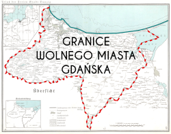
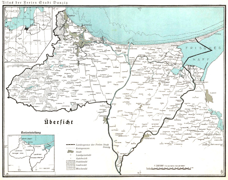
Po zakończeniu I wojny światowej, na mocy postanowień art. 100–108 Traktatu Wersalskiego, Gdańsk odłączono od Rzeszy Niemieckiej i zostało utworzone Wolne Miasto Gdańsk 15 listopada 1920.

Traktat dość ogólnie określał przebieg granic (w szczególności polsko-gdańskiej, gdyż gdańsko-niemiecka biegła w głównej mierze wzdłuż rzeki Nogat), więc ich docelowym kształtem zajęła się zajęła się specjalna między­narodowa Komisja do spraw Wytyczania Granicy Polsko-Gdańskiej. Komisja zakończyła swoje prace w 1922 r., więc setna rocznica tego wydarzenia, to dobry moment aby za pośrednictwem tej geościeżki przybliżyć Wam przebieg tych granic, jak i samego Wolnego Miasta Gdańska.


Caches in this GeoPath Granice Wolnego Miasta Gdańska

include following caches in gpx file:


inactive
ignored
placed by you
watched
founded
Logs count in gpx file*: 5

*) - for each cache. Available only for "GPX" files OK
information
Statistics for this GeoPath Granice Wolnego Miasta Gdańska
Your progress on this GeoPath


0% (You found 0 from 72 Caches in the Geopath)

Show more statistics

Opinions and comments

Log your visit